
Thank you for supporting this site ❤️
Make a donation
Make a donation
Tinguipaya topographic map
Click on the map to display elevation.
Thank you for supporting this site ❤️
Make a donation
Make a donation
About this map
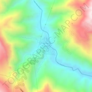
Name: Tinguipaya topographic map, elevation, terrain.
Average elevation: 3,391 m
Minimum elevation: 3,152 m
Maximum elevation: 3,743 m
Thank you for supporting this site ❤️
Make a donation
Make a donation
Other topographic maps
Click on a map to view its topography, its elevation and its terrain.
Challa Mayu
Bolivia > Potosí > Provincia Tomás Frías > Municipio Tinguipaya
Average elevation: 4,011 m