
Thank you for supporting this site ❤️
Make a donation
Make a donation
Mugardos topographic map
Click on the map to display elevation.
Thank you for supporting this site ❤️
Make a donation
Make a donation
About this map
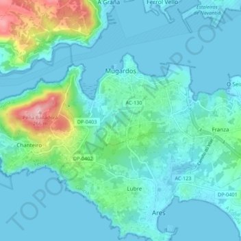
Name: Mugardos topographic map, elevation, terrain.
Location: Mugardos, Ferrol, A Coruña, Galicien, Spanien (43.43273 -8.27905 43.46621 -8.19594)
Average elevation: 40 m
Minimum elevation: -1 m
Maximum elevation: 259 m
Thank you for supporting this site ❤️
Make a donation
Make a donation
Other topographic maps
Click on a map to view its topography, its elevation and its terrain.