
Thank you for supporting this site ❤️
Make a donation
Make a donation
Falgunanda topographic map
Click on the map to display elevation.
Thank you for supporting this site ❤️
Make a donation
Make a donation
About this map
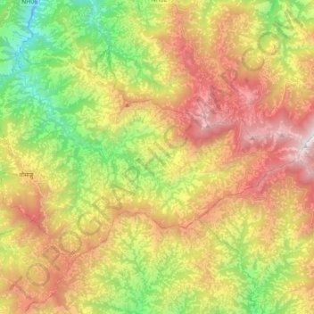
Name: Falgunanda topographic map, elevation, terrain.
Location: Falgunanda, Panchthar, Koshi Province, Nepal (26.99243 87.66832 27.10487 87.84468)
Average elevation: 1,694 m
Minimum elevation: 537 m
Maximum elevation: 3,009 m
Thank you for supporting this site ❤️
Make a donation
Make a donation
Other topographic maps
Click on a map to view its topography, its elevation and its terrain.