
Thank you for supporting this site ❤️
Make a donation
Make a donation
Mirepech topographic map
Click on the map to display elevation.
Thank you for supporting this site ❤️
Make a donation
Make a donation
About this map
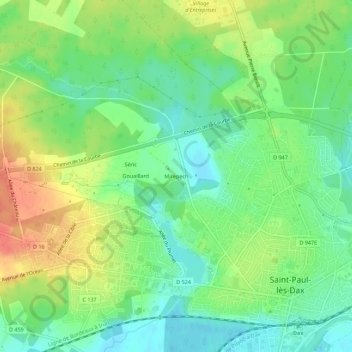
Name: Mirepech topographic map, elevation, terrain.
Average elevation: 23 m
Minimum elevation: 2 m
Maximum elevation: 53 m
Thank you for supporting this site ❤️
Make a donation
Make a donation
Other topographic maps
Click on a map to view its topography, its elevation and its terrain.
Lac de Christus
France > Nouvelle-Aquitaine > Landes > Saint-Paul-lès-Dax > Mirepech
Average elevation: 20 m