
Thank you for supporting this site ❤️
Make a donation
Make a donation
Maxial da Estrada topographic map
Click on the map to display elevation.
Thank you for supporting this site ❤️
Make a donation
Make a donation
About this map
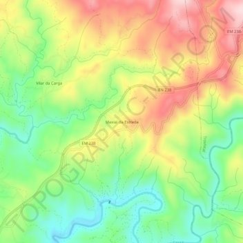
Name: Maxial da Estrada topographic map, elevation, terrain.
Location: Maxial da Estrada, Sertã, Castelo Branco, Portugal (39.82516 -8.07149 39.86516 -8.03149)
Average elevation: 396 m
Minimum elevation: 262 m
Maximum elevation: 558 m
Thank you for supporting this site ❤️
Make a donation
Make a donation
Other topographic maps
Click on a map to view its topography, its elevation and its terrain.