
Миси topographic map
Interactive map
Click on the map to display elevation.
About this map
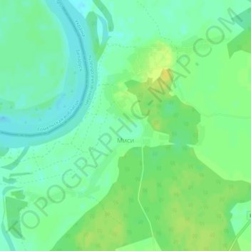
Name: Миси topographic map, elevation, terrain.
Location: Миси, Ріпкинський район, Oblast de Tchernigiv, 15042, Ucrânia (51.63324 30.56913 51.65422 30.60668)
Average elevation: 111 m
Minimum elevation: 102 m
Maximum elevation: 121 m
Other topographic maps
Click on a map to view its topography, its elevation and its terrain.
Rio Dniepre
Ucrânia > Oblast de Tchernigiv
Rio Dniepre, Ріпкинський район, Oblast de Tchernigiv, 74987, Ucrânia
Average elevation: 194 m