
Le Mas topographic map
Interactive map
Click on the map to display elevation.
About this map
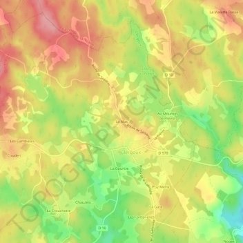
Name: Le Mas topographic map, elevation, terrain.
Average elevation: 550 m
Minimum elevation: 486 m
Maximum elevation: 596 m
Other topographic maps
Click on a map to view its topography, its elevation and its terrain.
La Gourcie
France > Nouvelle-Aquitaine > Corrèze > Clergoux
La Gourcie, Clergoux, Tulle, Corrèze, Nouvelle-Aquitaine, France métropolitaine, 19320, France
Average elevation: 545 m