
Athis-de-l'Orne topographic map
Interactive map
Click on the map to display elevation.
About this map
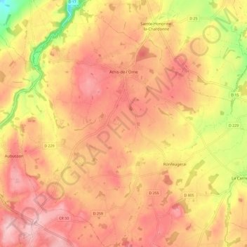
Name: Athis-de-l'Orne topographic map, elevation, terrain.
Average elevation: 217 m
Minimum elevation: 104 m
Maximum elevation: 278 m
Other topographic maps
Click on a map to view its topography, its elevation and its terrain.
La Bagotière
France > Normandie > Orne > Athis-Val-de-Rouvre > Ségrie-Fontaine
La Bagotière, Ségrie-Fontaine, Athis-Val-de-Rouvre, Argentan, Orne, Normandie, France métropolitaine, 61100, France
Average elevation: 152 m
L'Être aux Mores
France > Normandie > Orne > Athis-Val-de-Rouvre > Bréel
L'Être aux Mores, Bréel, Athis-Val-de-Rouvre, Argentan, Orne, Normandie, France métropolitaine, 61100, France
Average elevation: 161 m