
Thank you for supporting this site ❤️
Make a donation
Make a donation
Voeren - Fourons topographic map
Click on the map to display elevation.
Thank you for supporting this site ❤️
Make a donation
Make a donation
About this map
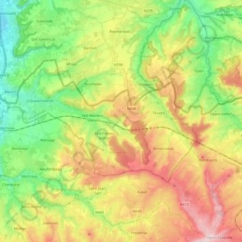
Name: Voeren - Fourons topographic map, elevation, terrain.
Location: Voeren - Fourons, Tongeren, Limburg, Flanders, Belgium (50.70986 5.68217 50.78325 5.91111)
Average elevation: 179 m
Minimum elevation: 49 m
Maximum elevation: 354 m
Thank you for supporting this site ❤️
Make a donation
Make a donation
Other topographic maps
Click on a map to view its topography, its elevation and its terrain.