
Sedgemoor topographic map
Interactive map
Click on the map to display elevation.
About this map
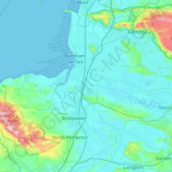
Name: Sedgemoor topographic map, elevation, terrain.
Location: Sedgemoor, Somerset, Zuidwest-Engeland, Engeland, VK (51.04084 -3.21646 51.33300 -2.70989)
Average elevation: 36 m
Minimum elevation: -1 m
Maximum elevation: 383 m