
Thank you for supporting this site ❤️
Make a donation
Make a donation
Benonchamps topographic map
Click on the map to display elevation.
Thank you for supporting this site ❤️
Make a donation
Make a donation
About this map
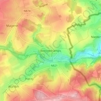
Name: Benonchamps topographic map, elevation, terrain.
Location: Benonchamps, Bastenaken, Luxemburg, Wallonië, België (49.98443 5.78868 50.02443 5.82868)
Average elevation: 462 m
Minimum elevation: 370 m
Maximum elevation: 541 m
Thank you for supporting this site ❤️
Make a donation
Make a donation
Other topographic maps
Click on a map to view its topography, its elevation and its terrain.