
L'Ameille topographic map
Interactive map
Click on the map to display elevation.
About this map
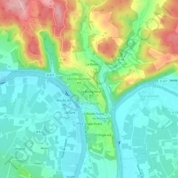
Name: L'Ameille topographic map, elevation, terrain.
Average elevation: 133 m
Minimum elevation: 74 m
Maximum elevation: 257 m
Other topographic maps
Click on a map to view its topography, its elevation and its terrain.
Loupiac
France > Occitanie > Lot > Puy-l'Évêque
Loupiac, Puy-l'Évêque, Cahors, Lot, Occitanie, France métropolitaine, 46700, France
Average elevation: 199 m