
Mousa topographic map
Interactive map
Click on the map to display elevation.
About this map
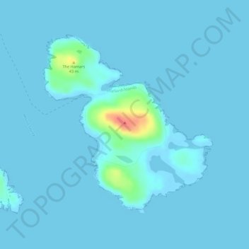
Name: Mousa topographic map, elevation, terrain.
Location: Mousa, Shetland, Scotland, United Kingdom (59.98941 -1.19335 60.00858 -1.15829)
Average elevation: 3 m
Minimum elevation: -2 m
Maximum elevation: 54 m
Other topographic maps
Click on a map to view its topography, its elevation and its terrain.
Sullom Voe
United Kingdom > Scotland > Shetland > Brae > Trondavoe
Sullom Voe, B9076, Trondavoe, Brae, Shetland, Scotland, ZE2 9SZ, United Kingdom
Average elevation: 6 m