La Pente de l'Aigri topographic map
Interactive map
Click on the map to display elevation.
About this map
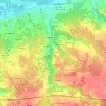
Name: La Pente de l'Aigri topographic map, elevation, terrain.
Average elevation: 99 m
Minimum elevation: 55 m
Maximum elevation: 131 m

Click on the map to display elevation.
Name: La Pente de l'Aigri topographic map, elevation, terrain.
Average elevation: 99 m
Minimum elevation: 55 m
Maximum elevation: 131 m