
Thank you for supporting this site ❤️
Make a donation
Make a donation
Los Altos topographic map
Click on the map to display elevation.
Thank you for supporting this site ❤️
Make a donation
Make a donation
About this map
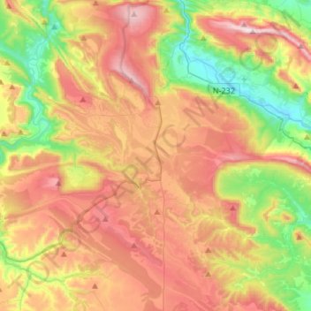
Name: Los Altos topographic map, elevation, terrain.
Location: Los Altos, Burgos, Castile and León, 09551, Spain (42.68302 -3.73054 42.87951 -3.54838)
Average elevation: 920 m
Minimum elevation: 567 m
Maximum elevation: 1,316 m
Thank you for supporting this site ❤️
Make a donation
Make a donation
Other topographic maps
Click on a map to view its topography, its elevation and its terrain.