
Hickory Hill topographic map
Interactive map
Click on the map to display elevation.
About this map
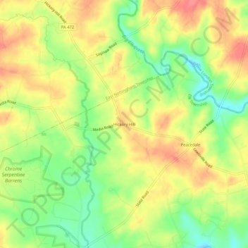
Name: Hickory Hill topographic map, elevation, terrain.
Average elevation: 123 m
Minimum elevation: 87 m
Maximum elevation: 153 m
Other topographic maps
Click on a map to view its topography, its elevation and its terrain.
Lewisville
United States > Pennsylvania > Chester County > Elk Township
Lewisville, Elk Township, Chester County, Pennsylvania, 19351, United States
Average elevation: 101 m