
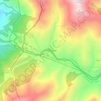
Arbas del Puerto topographic map
Interactive map
Click on the map to display elevation.
About this map
Name: Arbas del Puerto topographic map, elevation, terrain.
Average elevation: 1,471 m
Minimum elevation: 956 m
Maximum elevation: 1,986 m
Other topographic maps
Click on a map to view its topography, its elevation and its terrain.
Cubillas de Arbás
España > Castilla y León > Villamanín
Cubillas de Arbás, Villamanín, León, Castilla y León, España
Average elevation: 1,485 m
Puerto de Pajares
España > Castilla y León > Villamanín
Puerto de Pajares, Villamanín, La Robla, Castilla y León, 33693, España
Average elevation: 1,361 m
Valle Vainilla
España > Castilla y León > Villamanín > Busdongo
Valle Vainilla, Busdongo, Villamanín, La Robla, Castilla y León, 24690, España
Average elevation: 1,414 m