
Jungeroth topographic map
Interactive map
Click on the map to display elevation.
About this map
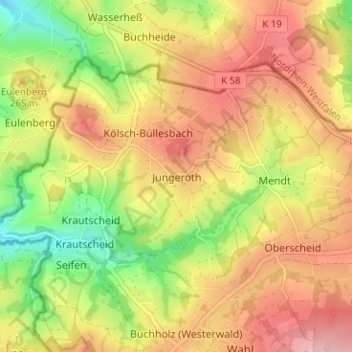
Name: Jungeroth topographic map, elevation, terrain.
Average elevation: 236 m
Minimum elevation: 155 m
Maximum elevation: 303 m
Other topographic maps
Click on a map to view its topography, its elevation and its terrain.
Rheinbrohl
Deutschland > Rheinland-Pfalz > Landkreis Neuwied
Rheinbrohl, Bad Hönningen, Landkreis Neuwied, Rheinland-Pfalz, 56598, Deutschland
Average elevation: 164 m