
Zachow topographic map
Interactive map
Click on the map to display elevation.
About this map
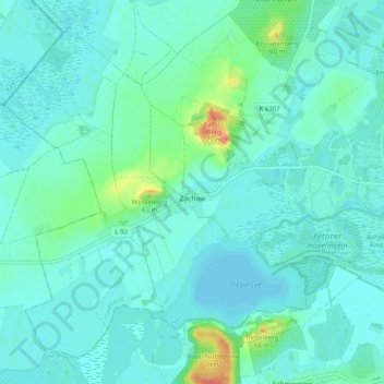
Name: Zachow topographic map, elevation, terrain.
Location: Zachow, Ketzin/Havel, Havelland, Brandenburg, Deutschland (52.45804 12.73411 52.51046 12.83414)
Average elevation: 34 m
Minimum elevation: 26 m
Maximum elevation: 72 m
Other topographic maps
Click on a map to view its topography, its elevation and its terrain.
Klemensberg
Deutschland > Brandenburg > Havelland > Ketzin/Havel > Tremmen
Klemensberg, Tremmen, Ketzin/Havel, Havelland, Brandenburg, 14669, Deutschland
Average elevation: 38 m
Trebelsee
Deutschland > Brandenburg > Havelland > Ketzin/Havel > Zachow
Trebelsee, Zachow, Ketzin/Havel, Havelland, Brandenburg, Deutschland
Average elevation: 33 m