
Kellas topographic map
Interactive map
Click on the map to display elevation.
About this map
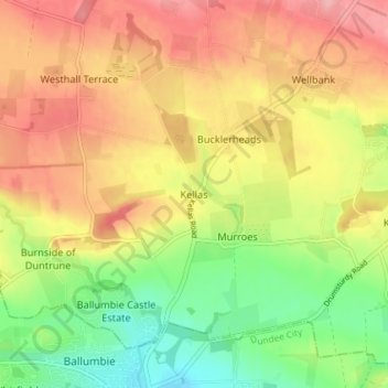
Name: Kellas topographic map, elevation, terrain.
Location: Kellas, Angus, Scotland, DD5 3GX, United Kingdom (56.48912 -2.90383 56.52912 -2.86383)
Average elevation: 95 m
Minimum elevation: 34 m
Maximum elevation: 151 m
Other topographic maps
Click on a map to view its topography, its elevation and its terrain.
Ironshill
United Kingdom > Scotland > Angus > Inverkeilor
Ironshill, Inverkeilor, Angus, Scotland, DD11 5SR, United Kingdom
Average elevation: 36 m