
Hoeksche Waard topographic map
Interactive map
Click on the map to display elevation.
About this map
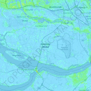
Name: Hoeksche Waard topographic map, elevation, terrain.
Location: Hoeksche Waard, South Holland, Netherlands (51.70053 4.22756 51.83434 4.62959)
Average elevation: 0 m
Minimum elevation: -5 m
Maximum elevation: 20 m
Other topographic maps
Click on a map to view its topography, its elevation and its terrain.
Kaag
Kaag, Kaag en Braassem, South Holland, Netherlands
Average elevation: -2 m
Voorne-Putten
Voorne-Putten, South Holland, Netherlands
Average elevation: 1 m
Rotterdam
Netherlands > South Holland > Rotterdam
Rotterdam, South Holland, Netherlands
Average elevation: 0 m
Noordwijk
Netherlands > South Holland > Noordwijk
Noordwijk, South Holland, Netherlands
Average elevation: 1 m