
Thank you for supporting this site ❤️
Make a donation
Make a donation
Punkin Center topographic map
Click on the map to display elevation.
Thank you for supporting this site ❤️
Make a donation
Make a donation
About this map
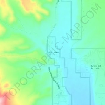
Name: Punkin Center topographic map, elevation, terrain.
Location: Punkin Center, Gila County, Arizona, 85553, United States (33.85227 -111.33319 33.89227 -111.29319)
Average elevation: 742 m
Minimum elevation: 690 m
Maximum elevation: 897 m
Thank you for supporting this site ❤️
Make a donation
Make a donation