
Plakias topographic map
Interactive map
Click on the map to display elevation.
About this map
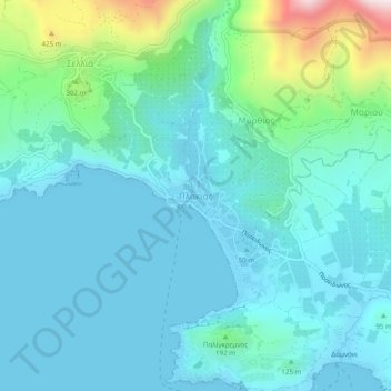
Name: Plakias topographic map, elevation, terrain.
Average elevation: 123 m
Minimum elevation: -3 m
Maximum elevation: 716 m
Other topographic maps
Click on a map to view its topography, its elevation and its terrain.
Thronos
Griechenland > Region Kreta > Regionalbezirk Rethymno
Thronos, Provinz Amari, Regionalbezirk Rethymno, Region Kreta, 740 61, Griechenland
Average elevation: 527 m
Rethymno
Griechenland > Region Kreta > Regionalbezirk Rethymno
Rethymno, Provinz Rethymnon, Regionalbezirk Rethymno, Region Kreta, 741 31, Griechenland
Average elevation: 204 m
Atsipopoulo
Griechenland > Region Kreta > Regionalbezirk Rethymno > Atsipopoulo
Atsipopoulo, Provinz Rethymnon, Regionalbezirk Rethymno, Region Kreta, 74132, Griechenland
Average elevation: 143 m