
Thank you for supporting this site ❤️
Make a donation
Make a donation
Pleasant Plains topographic map
Click on the map to display elevation.
Thank you for supporting this site ❤️
Make a donation
Make a donation
About this map
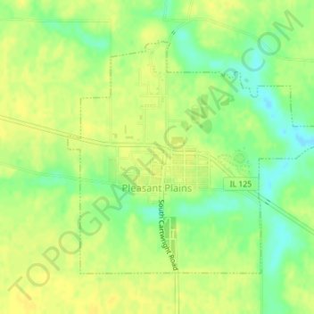
Name: Pleasant Plains topographic map, elevation, terrain.
Location: Pleasant Plains, Sangamon County, Illinois, United States (39.86548 -89.93121 39.88543 -89.90122)
Average elevation: 187 m
Minimum elevation: 173 m
Maximum elevation: 193 m
Thank you for supporting this site ❤️
Make a donation
Make a donation
Other topographic maps
Click on a map to view its topography, its elevation and its terrain.