Geolocate

Reinbeck topographic map

Interactive map

Click on the map to display elevation.

About this map

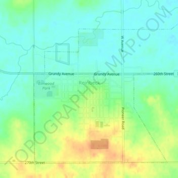
Name: Reinbeck topographic map, elevation, terrain.

Location: Reinbeck, Grundy County, Iowa, 50669, United States (42.31129 -92.61153 42.33518 -92.57248)

Average elevation: 290 m

Minimum elevation: 276 m

Maximum elevation: 312 m

Other topographic maps

Click on a map to view its topography, its elevation and its terrain.

Grundy Center

United States > Iowa > Grundy County

Grundy Center, Grundy County, Iowa, United States

Average elevation: 306 m

Dike

United States > Iowa > Grundy County

Dike, Grundy County, Iowa, United States

Average elevation: 291 m

Beaman

United States > Iowa > Grundy County

Beaman, Grundy County, Iowa, United States

Average elevation: 309 m

Wellsburg

United States > Iowa > Grundy County

Wellsburg, Grundy County, Iowa, United States

Average elevation: 327 m

Holland

United States > Iowa > Grundy County

Holland, Grundy County, Iowa, United States

Average elevation: 310 m

Conrad

United States > Iowa > Grundy County

Conrad, Grundy County, Iowa, 50621, United States

Average elevation: 313 m

Stout

United States > Iowa > Grundy County

Stout, Grundy County, Iowa, 50673, United States

Average elevation: 309 m

Morrison

United States > Iowa > Grundy County

Morrison, Grundy County, Iowa, 50657, United States

Average elevation: 295 m