
Zorritos topographic map
Interactive map
Click on the map to display elevation.
About this map
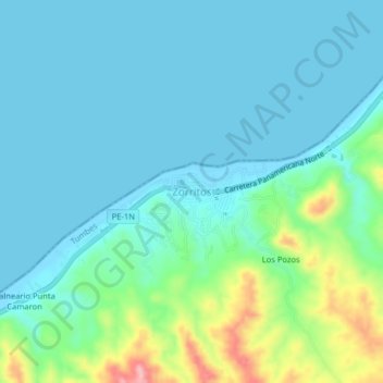
Name: Zorritos topographic map, elevation, terrain.
Location: Zorritos, Contralmirante Villar, Tumbes, Perú (-3.70053 -80.69974 -3.66053 -80.65974)
Average elevation: 32 m
Minimum elevation: 0 m
Maximum elevation: 163 m
Other topographic maps
Click on a map to view its topography, its elevation and its terrain.