Geolocate

Albacken topographic map

Interactive map

Click on the map to display elevation.

About this map

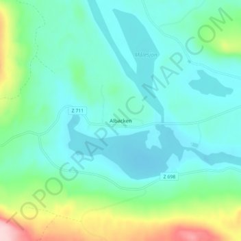
Name: Albacken topographic map, elevation, terrain.

Location: Albacken, Bräcke kommun, Jämtland County, Sweden (62.76032 15.99640 62.80032 16.03640)

Average elevation: 253 m

Minimum elevation: 203 m

Maximum elevation: 432 m

Other topographic maps

Click on a map to view its topography, its elevation and its terrain.

Björnänge

Sweden > Jämtland County > Åre Björnen

Björnänge, Åre Björnen, Åre kommun, Jämtland County, 837 91, Sweden

Average elevation: 479 m

Tandsbyn

Sweden > Jämtland County

Tandsbyn, Östersunds kommun, Jämtland County, Sweden

Average elevation: 380 m

Hammarstrand

Sweden > Jämtland County

Hammarstrand, Ragunda kommun, Jämtland County, 844 31, Sweden

Average elevation: 231 m