
Thank you for supporting this site ❤️
Make a donation
Make a donation
Douglas Pass topographic map
Click on the map to display elevation.
Thank you for supporting this site ❤️
Make a donation
Make a donation
Douglas Pass
Douglas Pass, elevation 8,205 feet (2,501 meters), is a mountain pass in the Book Cliffs of western Colorado. It is located in Garfield County and is traversed by State Highway 139. The pass divides the watersheds of West Douglas Creek to the north and East Salt Creek to the south. It is named for the Northern Ute, Chief Douglas.
Thank you for supporting this site ❤️
Make a donation
Make a donation
About this map
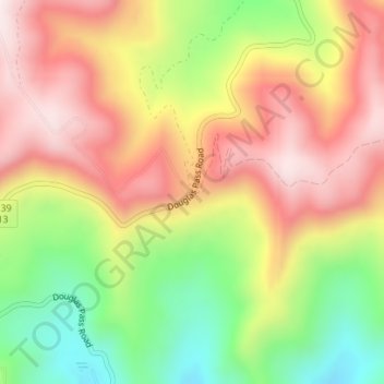
Name: Douglas Pass topographic map, elevation, terrain.
Location: Douglas Pass, Garfield County, Colorado, United States (39.59766 -108.80499 39.59776 -108.80489)
Average elevation: 2,435 m
Minimum elevation: 2,137 m
Maximum elevation: 2,694 m
Thank you for supporting this site ❤️
Make a donation
Make a donation
Other topographic maps
Click on a map to view its topography, its elevation and its terrain.