
仲达乡 topographic map
Interactive map
Click on the map to display elevation.
About this map
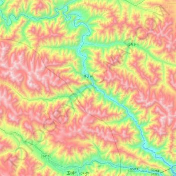
Name: 仲达乡 topographic map, elevation, terrain.
Location: 仲达乡, 玉树市, 玉树藏族自治州, 青海省, 中国 (32.99925 96.80005 33.35111 97.24950)
Average elevation: 4,297 m
Minimum elevation: 3,523 m
Maximum elevation: 5,147 m
Other topographic maps
Click on a map to view its topography, its elevation and its terrain.