
Monte Scherbelino topographic map
Interactive map
Click on the map to display elevation.
About this map
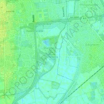
Name: Monte Scherbelino topographic map, elevation, terrain.
Average elevation: 93 m
Minimum elevation: 87 m
Maximum elevation: 100 m
Other topographic maps
Click on a map to view its topography, its elevation and its terrain.
Frankenthal (Pfalz)
Deutschland > Rheinland-Pfalz > Frankenthal (Pfalz)
Frankenthal (Pfalz), Rheinland-Pfalz, 67227, Deutschland
Average elevation: 95 m
Am Rhein
Deutschland > Rheinland-Pfalz > Frankenthal (Pfalz)
Am Rhein, Mörsch, Frankenthal (Pfalz), Rheinland-Pfalz, 67227, Deutschland
Average elevation: 92 m