
Thank you for supporting this site ❤️
Make a donation
Make a donation
Mountain View topographic map
Click on the map to display elevation.
Thank you for supporting this site ❤️
Make a donation
Make a donation
About this map
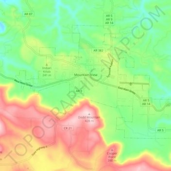
Name: Mountain View topographic map, elevation, terrain.
Location: Mountain View, Stone County, Arkansas, 72560, United States (35.83535 -92.15761 35.89139 -92.06016)
Average elevation: 248 m
Minimum elevation: 124 m
Maximum elevation: 424 m
Thank you for supporting this site ❤️
Make a donation
Make a donation
Other topographic maps
Click on a map to view its topography, its elevation and its terrain.