
Schofield topographic map
Click on the map to display elevation.
About this map
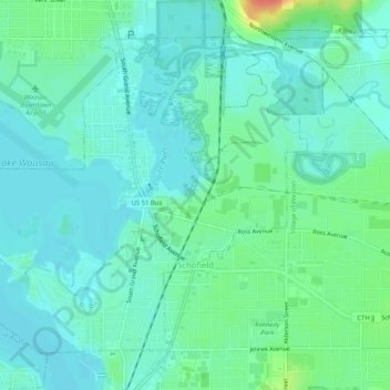
Name: Schofield topographic map, elevation, terrain.
Location: Schofield, Marathon County, Wisconsin, United States (44.90147 -89.64112 44.93086 -89.58990)
Average elevation: 364 m
Minimum elevation: 351 m
Maximum elevation: 405 m
Other topographic maps
Click on a map to view its topography, its elevation and its terrain.
George W Mead State Wildlife Management Area
United States > Wisconsin > Marathon County > Town of Bergen
Average elevation: 343 m