
Thank you for supporting this site ❤️
Make a donation
Make a donation
Mount Marapi topographic map
Click on the map to display elevation.
Thank you for supporting this site ❤️
Make a donation
Make a donation
About this map
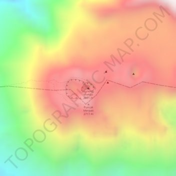
Name: Mount Marapi topographic map, elevation, terrain.
Location: Mount Marapi, Agam, West Sumatra, Sumatra, Indonesia (-0.39116 100.45709 -0.39106 100.45719)
Average elevation: 2,457 m
Minimum elevation: 1,933 m
Maximum elevation: 2,846 m
Thank you for supporting this site ❤️
Make a donation
Make a donation