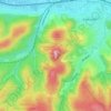
Bad Liebenstein topographic map
Click on the map to display elevation.
About this map

Name: Bad Liebenstein topographic map, elevation, terrain.
Location: Bad Liebenstein, Wartburgkreis, Thuringia, Germany (50.77870 10.29678 50.87039 10.41205)
Average elevation: 424 m
Minimum elevation: 239 m
Maximum elevation: 748 m
Other topographic maps
Click on a map to view its topography, its elevation and its terrain.
Wartburg
Germany > Thuringia > Wartburgkreis > Eisenach
The Wartburg (German pronunciation: [ˈvaʁtbʊʁk]) is a castle originally built in the Middle Ages. At an elevation of 410 metres (1,350 ft) in the state of Thuringia, Germany, it is situated on a southwest-facing precipice and overlooks the town of Eisenach to the north. It was the home of St. Elisabeth of…
Average elevation: 284 m