
囊谦县 topographic map
Interactive map
Click on the map to display elevation.
About this map
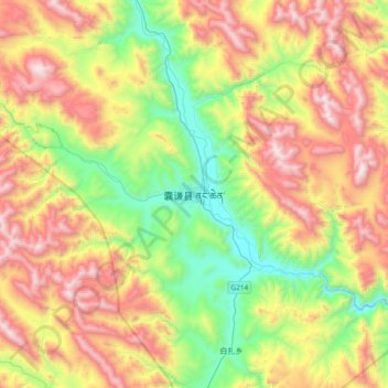
Name: 囊谦县 topographic map, elevation, terrain.
Location: 囊谦县, 玉树藏族自治州, 青海省, 中国 (32.04368 96.31864 32.36368 96.63864)
Average elevation: 4,248 m
Minimum elevation: 3,582 m
Maximum elevation: 5,153 m
Other topographic maps
Click on a map to view its topography, its elevation and its terrain.