
Thank you for supporting this site ❤️
Make a donation
Make a donation
Luis Lopez topographic map
Click on the map to display elevation.
Thank you for supporting this site ❤️
Make a donation
Make a donation
About this map
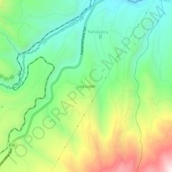
Name: Luis Lopez topographic map, elevation, terrain.
Location: Luis Lopez, Yanayacu, Quero, Tungurahua, Ecuador (-1.46668 -78.68769 -1.42668 -78.64769)
Average elevation: 3,458 m
Minimum elevation: 3,152 m
Maximum elevation: 4,005 m
Thank you for supporting this site ❤️
Make a donation
Make a donation