
Waverly topographic map
Interactive map
Click on the map to display elevation.
About this map
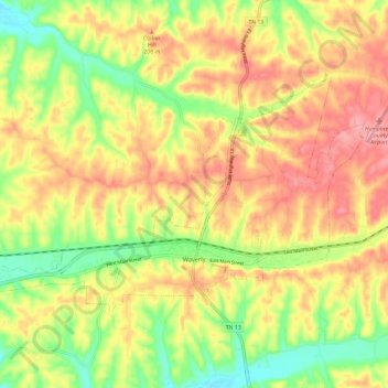
Name: Waverly topographic map, elevation, terrain.
Location: Waverly, Humphreys County, Tennessee, United States (36.06999 -87.86097 36.12815 -87.74242)
Average elevation: 182 m
Minimum elevation: 123 m
Maximum elevation: 233 m
Other topographic maps
Click on a map to view its topography, its elevation and its terrain.
McEwen
United States > Tennessee > Humphreys County
McEwen, Humphreys County, Middle Tennessee, Tennessee, 37101, United States
Average elevation: 247 m
Humphreys County
United States > Tennessee > Humphreys County
Humphreys County, Tennessee, United States
Average elevation: 174 m