
Thank you for supporting this site ❤️
Make a donation
Make a donation
Aïn Bouyahia topographic map
Click on the map to display elevation.
Thank you for supporting this site ❤️
Make a donation
Make a donation
About this map
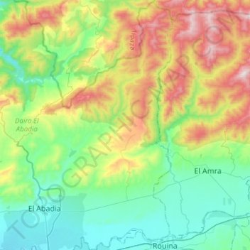
Name: Aïn Bouyahia topographic map, elevation, terrain.
Location: Aïn Bouyahia, El Abadia District, Aïn Defla, 44360, Algeria (36.24141 1.69321 36.44197 1.81339)
Average elevation: 436 m
Minimum elevation: 97 m
Maximum elevation: 1,035 m
Thank you for supporting this site ❤️
Make a donation
Make a donation