
Thank you for supporting this site ❤️
Make a donation
Make a donation
Thal topographic map
Click on the map to display elevation.
Thank you for supporting this site ❤️
Make a donation
Make a donation
About this map
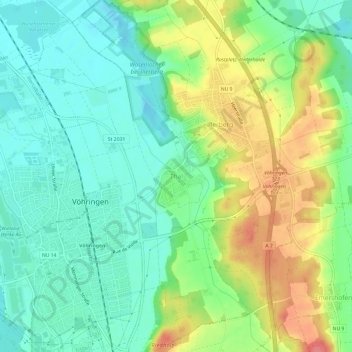
Name: Thal topographic map, elevation, terrain.
Location: Thal, Vöhringen, Landkreis Neu-Ulm, Bayern, 89269, Deutschland (48.26617 10.07798 48.30617 10.11798)
Average elevation: 515 m
Minimum elevation: 488 m
Maximum elevation: 561 m
Thank you for supporting this site ❤️
Make a donation
Make a donation
Other topographic maps
Click on a map to view its topography, its elevation and its terrain.