
景谷傣族彝族自治县 topographic map
Interactive map
Click on the map to display elevation.
About this map
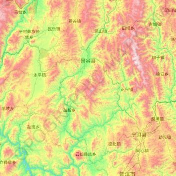
Name: 景谷傣族彝族自治县 topographic map, elevation, terrain.
Location: 景谷傣族彝族自治县, Pu’er, Yunnan, 665000, China (22.81357 100.04424 23.86240 101.11945)
Average elevation: 1,415 m
Minimum elevation: 623 m
Maximum elevation: 2,832 m