
Tarryall topographic map
Click on the map to display elevation.
About this map
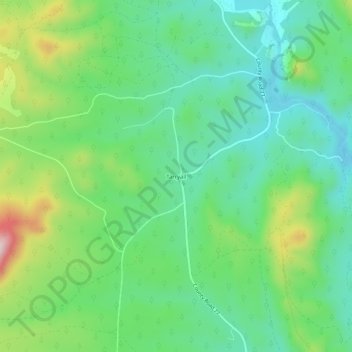
Name: Tarryall topographic map, elevation, terrain.
Location: Tarryall, Park County, Colorado, United States (39.10194 -105.49556 39.14194 -105.45556)
Average elevation: 2,684 m
Minimum elevation: 2,577 m
Maximum elevation: 2,923 m
Other topographic maps
Click on a map to view its topography, its elevation and its terrain.
Fairplay
United States > Colorado > Park County
The historic Town of Fairplay is the Statutory Town that is the county seat and the most populous municipality of Park County, Colorado, United States. The town population was 724 at the 2020 United States Census. Fairplay is located in South Park at an elevation of 9,953 feet (3,034 m). The town is the…
Average elevation: 3,045 m
Fairplay
United States > Colorado > Park County
The historic Town of Fairplay is the Statutory Town that is the county seat and the most populous municipality of Park County, Colorado, United States. The town population was 724 at the 2020 United States Census. Fairplay is located in South Park at an elevation of 9,953 feet (3,034 m). The town is the…
Average elevation: 3,040 m
Fairplay
United States > Colorado > Park County
The historic Town of Fairplay is the Statutory Town that is the county seat and the most populous municipality of Park County, Colorado, United States. The town population was 724 at the 2020 United States Census. Fairplay is located in South Park at an elevation of 9,953 feet (3,034 m). The town is the…
Average elevation: 3,045 m
Alma
United States > Colorado > Park County
At an elevation of approximately 10,522 feet (3,207 m), Alma is the highest incorporated municipality in the United States when considering only areas with permanent residents. Its post office is located at the highest elevation of any in the country. Alma, which is considered a town and not a city, does not…
Average elevation: 3,212 m
Alma
United States > Colorado > Park County
At an elevation of approximately 10,578 feet (3,224 m), Alma is the highest incorporated municipality in the United States when considering only areas with permanent residents. Its post office is located at the highest elevation of any in the country. Alma, which is considered a town and not a city, does not…
Average elevation: 3,212 m
Fairplay
United States > Colorado > Park County
Fairplay is a statutory town that is the county seat and the most populous municipality of Park County, Colorado, United States. The town population was 724 at the 2020 United States Census. Fairplay is located in South Park at an elevation of 9,953 feet (3,034 m). The town is the fifth-highest incorporated…
Average elevation: 3,045 m
Alma
United States > Colorado > Park County
At an elevation of approximately 10,522 feet (3,207 m), Alma is the highest incorporated municipality in the United States when considering only areas with permanent residents. Its post office is located at the highest elevation of any in the country. Alma, which is considered a town and not a city, does not…
Average elevation: 3,212 m
Alma
United States > Colorado > Park County
At an elevation of 10,361 feet (3,158 m), Alma is the highest incorporated municipality in the United States when considering only areas with permanent residents. Its post office is located at the highest elevation of any in the country. Alma, which is considered a town and not a city, does not take the title…
Average elevation: 3,212 m