
Frankfurt (Oder) topographic map
Interactive map
Click on the map to display elevation.
About this map
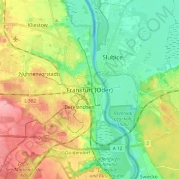
Name: Frankfurt (Oder) topographic map, elevation, terrain.
Location: Frankfurt (Oder), Brandenburg, 15230, Deutschland (52.30123 14.50945 52.38123 14.58945)
Average elevation: 49 m
Minimum elevation: 9 m
Maximum elevation: 110 m
Am 1. April 1930 wurde der Neubau der staatlichen Baugewerkschule (Höhere Technische Staatslehranstalt für Hoch- und Tiefbau) eingeweiht.