
Lara topographic map
Interactive map
Click on the map to display elevation.
About this map
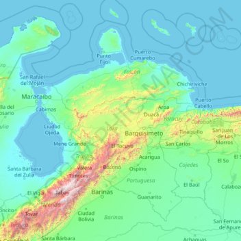
Name: Lara topographic map, elevation, terrain.
Location: Lara, Región Centroccidental, Venezuela (7.66845 -72.37980 12.78845 -67.25980)
Average elevation: 275 m
Minimum elevation: -5 m
Maximum elevation: 4,773 m