
Dras topographic map
Interactive map
Click on the map to display elevation.
About this map
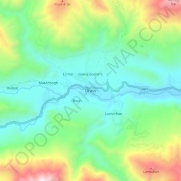
Name: Dras topographic map, elevation, terrain.
Location: Dras, Kargil, Kargil District, Ladakh, India (34.38927 75.71076 34.46927 75.79076)
Average elevation: 3,531 m
Minimum elevation: 3,045 m
Maximum elevation: 4,707 m