
Kindia Region topographic map
Interactive map
Click on the map to display elevation.
About this map
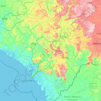
Name: Kindia Region topographic map, elevation, terrain.
Location: Kindia Region, Guinea (9.03412 -14.01236 11.38009 -12.11009)
Average elevation: 259 m
Minimum elevation: -1 m
Maximum elevation: 1,401 m