
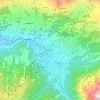
Les Diablerets topographic map
Interactive map
Click on the map to display elevation.
About this map
Name: Les Diablerets topographic map, elevation, terrain.
Average elevation: 1,453 m
Minimum elevation: 1,110 m
Maximum elevation: 2,257 m
Other topographic maps
Click on a map to view its topography, its elevation and its terrain.
Vers l'Église
Suisse > Vaud > District d'Aigle > Ormont-Dessus
Vers l'Église, Ormont-Dessus, District d'Aigle, Vaud, 1864, Suisse
Average elevation: 1,460 m