
黄家街道 topographic map
Interactive map
Click on the map to display elevation.
About this map
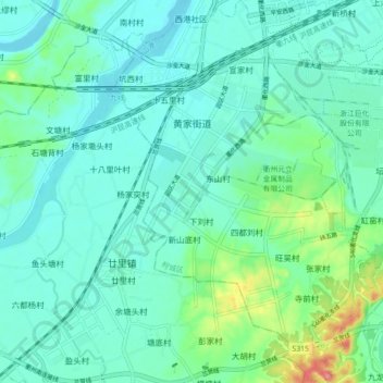
Name: 黄家街道 topographic map, elevation, terrain.
Location: 黄家街道, 柯城区, 衢州市, 浙江省, 中国 (28.85131 118.82915 28.92884 118.89110)
Average elevation: 81 m
Minimum elevation: 59 m
Maximum elevation: 169 m