
Somers topographic map
Interactive map
Click on the map to display elevation.
About this map
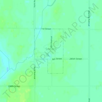
Name: Somers topographic map, elevation, terrain.
Location: Somers, Calhoun County, Iowa, United States (42.37198 -94.43635 42.38392 -94.42605)
Average elevation: 352 m
Minimum elevation: 346 m
Maximum elevation: 357 m
Other topographic maps
Click on a map to view its topography, its elevation and its terrain.
Rands
United States > Iowa > Calhoun County
Rands, Calhoun County, Iowa, United States
Average elevation: 358 m
Lake City
United States > Iowa > Calhoun County > Lake City
Lake City, Calhoun County, Iowa, 51449, United States
Average elevation: 367 m
Pomeroy
United States > Iowa > Calhoun County
Pomeroy, Calhoun County, Iowa, 50575, United States
Average elevation: 375 m