
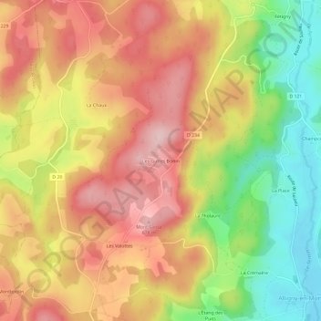
Les Guttes Bonin topographic map
Interactive map
Click on the map to display elevation.
About this map
Name: Les Guttes Bonin topographic map, elevation, terrain.
Average elevation: 581 m
Minimum elevation: 450 m
Maximum elevation: 686 m
Other topographic maps
Click on a map to view its topography, its elevation and its terrain.
Pierre Écrite
France > Bourgogne-Franche-Comté > Nièvre > Alligny-en-Morvan
Pierre Écrite, Alligny-en-Morvan, Château-Chinon (Ville), Nièvre, Bourgogne-Franche-Comté, France métropolitaine, 58230, France
Average elevation: 558 m