
Mezita topographic map
Interactive map
Click on the map to display elevation.
About this map
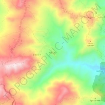
Name: Mezita topographic map, elevation, terrain.
Location: Mezita, Beni Maouche, Daïra Beni Maouche, Béjaïa, 06024, Algérie (36.49124 4.76923 36.53124 4.80923)
Average elevation: 745 m
Minimum elevation: 477 m
Maximum elevation: 1,000 m
Other topographic maps
Click on a map to view its topography, its elevation and its terrain.
Tizert
Algérie > Béjaïa > Daïra Beni Maouche > Beni Maouche
Tizert, Beni Maouche, Daïra Beni Maouche, Béjaïa, 06024, Algérie
Average elevation: 848 m
Bouikni
Algérie > Béjaïa > Daïra Beni Maouche > Beni Maouche
Bouikni, Beni Maouche, Daïra Beni Maouche, Béjaïa, 06024, Algérie
Average elevation: 838 m